|
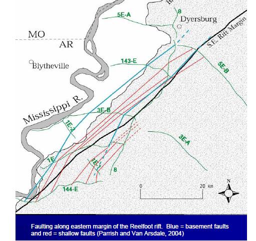
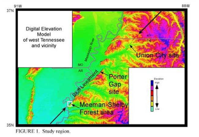
Meeman-Shelby Fault / Porter's Gap Fault in West TennesseeEditor's comment: the two names above refer to very similar or same areas.
Evidence seems to show a sizeable quake here 2,000 years ago. One dig found a horizontal displacement of 8-15 meters (25-50 feet). On September 28, 2009, Van Arsdale spoke at University of Tennessee-Martin. The campus newspaper says "Van Arsdale pointed out the double "monster" fault lines that basically run along a line in West Tennessee dividing the flood plain from the bluffs. He called it the Porter's Gap fault, and it is geographically close to both Martin and Memphis. "Van Arsdale began his speech with detailed descriptions of the geology of this area, using numerous maps to demonstrate the "checkerboard" structure of the New Madrid fault system and defining the Reelfoot Rift and the directional movements of the ground. He said an east-west horizontal compression of the ground is occurring within the fault system, which led him to pose a question: 'Is it possible that some of the other (New Madrid) faults may be under strain, even though they haven't been recently seismically active?'
"The probability of a cluster of deadly (near 8.0 magnitude on the Richter scale) earthquakes - like those that occurred in the winter months of 1811 and 1812 isn't likely for about another 300 years. "It's more realistic in our lifespan to prepare for 6.5-magnitude quakes. The threats from a 6.5-magnitude quake would include flooding in the Mississippi River flood plain if levees gave way; cracked and broken foundations of homes and buildings, among other engineering problems, if liquefaction occurred with the quake; cracked or broken pipelines carrying oil, gas and other products; and any damage incurred to property by the rolling of the ground. Liquefaction is when sand and water shoot out of the ground through vents and create "sand blows" on top of the clay soil top layer prevalent in West Tennessee. Those "sand blows" can become akin to quicksand, he said. "When liquefaction occurs, it's a very expensive problem," Van Arsdale said, adding that liquefaction is less of a threat today because of drainage ditches and other factors, which have lowered the water table in West Tennessee.
Van Arsdale, who currently is a professor of geology at the University of Memphis, has also worked as a geologist for several companies, including Standard Oil of California and the Union Carbide Corp. He is an expert on the New Madrid seismic zone and has participated in several TV documentaries, including programs developed by the National Geographic Society Channel and the History Channel. When asked about funding for continued study of the New Madrid system, Van Arsdale said he is hopeful that the U.S. Geological Survey office in Memphis will soon receive some of the stimulus money given to the Department of the Interior, which oversees USGS. "The San Andreas fault system in California certainly receives more study funding and more publicity because of its activity," Van Arsdale said. "Quakes are always imminent and often a quake on one of the faults can trigger activity on a nearby fault. Of course, we know what the trigger mechanism is for the San Andreas system - its location on the edge of a tectonic plate. We don't know yet what the trigger mechanism is for the New Madrid system." "People in this area are definitely aware of the New Madrid fault system, and are much more willing to cooperate with geologists than others I've approached in other states," Van Arsdale said. "In Kentucky, Tennessee and Arkansas, people are very curious and will let you onto their property. All they ask for in return is a copy of our report." [The following notes on a new fault "near Memphis" seems to refer to the same as above. The notes below come from PBS.]
Meeman-Shelby fault - 30 mi. long, along bluffs NW of Memphis. "We don't know whether the fault is inactive or quiescent. Faults like this, far away from the plate boundaries, have a long repeat time. They might be quiescent for 1,000 to 3,500 years and then, all of a sudden, trigger a magnitude 8.0." Maria Beatrice Magnani is an Assistant Research Professor at Univ. of Memphis who in summer 2008 went on a barge from about Caruthersville to Marked Tree, taking soundings of the river bottom to a depth of nearly one mile, covering about half a million years of sediment deposit. Little has been published yet on the findings.
|