Olmsted fault: Connecting New Madrid to Wabash Valley
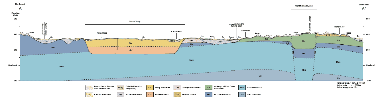
To the immediate east northeast of Pulaski quadrangle is the Cypress quadrangle. Of interest is the Cache River valley and Olmsted fault. A new large lock and dam is under construction on the Ohio River near Olmstead. See cross section at bottom of this pdf. http://www.isgs.uiuc.edu/maps-data-pub/statemap/pdf-files/cypress-g.pdf
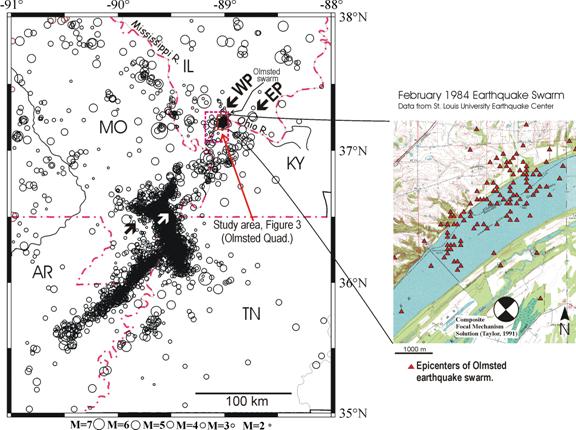
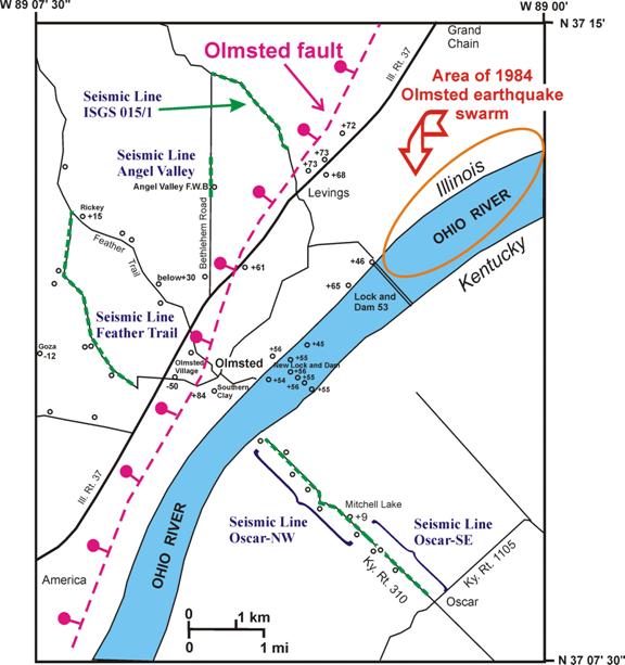
This map shows the Olmsted fault going literally through Olmsted and within a mile or so of the new and old locks and dams Click the map for the source. New Madrid and Wabash Valley faults are connected through here and Rough Creek Graben.
The "feather trail" went from this spot - New Caledonia - to Jonesboro IL, and was one of the earliest European trails in Southern Illinois. It was said to be littered with feathers of caged chickens on their way to market.
Earthquakes in Southern Illinois The quake lines in right side of map are a connection between the Wabash and New Madrid Faults.
Cross section below - click for double size -is cross-section of land between Ullin and Grand Chain, showing Perks Road, Shawnee College with Olmsted fault underneath, and Illinois Route 37. The yellow-salmon colored channel probably carried the Ohio River at one time, perhaps when the ocean levels were lower than now.
Engineering Geology
Volume 81, Issue 2, October 2005, Pages 179-201
C.E. Bexfield and others
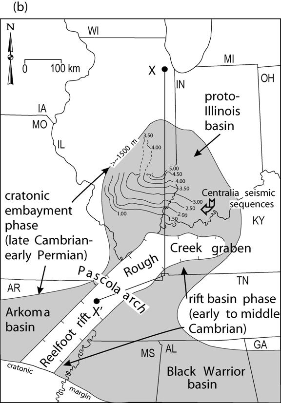
We have mapped an intricate zone more than 8 km wide of high-angle faults in Mississippi embayment sediments localized over Paleozoic bedrock faults that trend north to northeast, parallel to the Ohio River.
These faults align with the pattern of epicenters in the New Madrid seismic zone. The largest fault, the Olmsted fault, underwent principal displacement near the end of the Cretaceous Period 65 to 70 million years ago. Strata of this age (dated via fossil pollen)