|
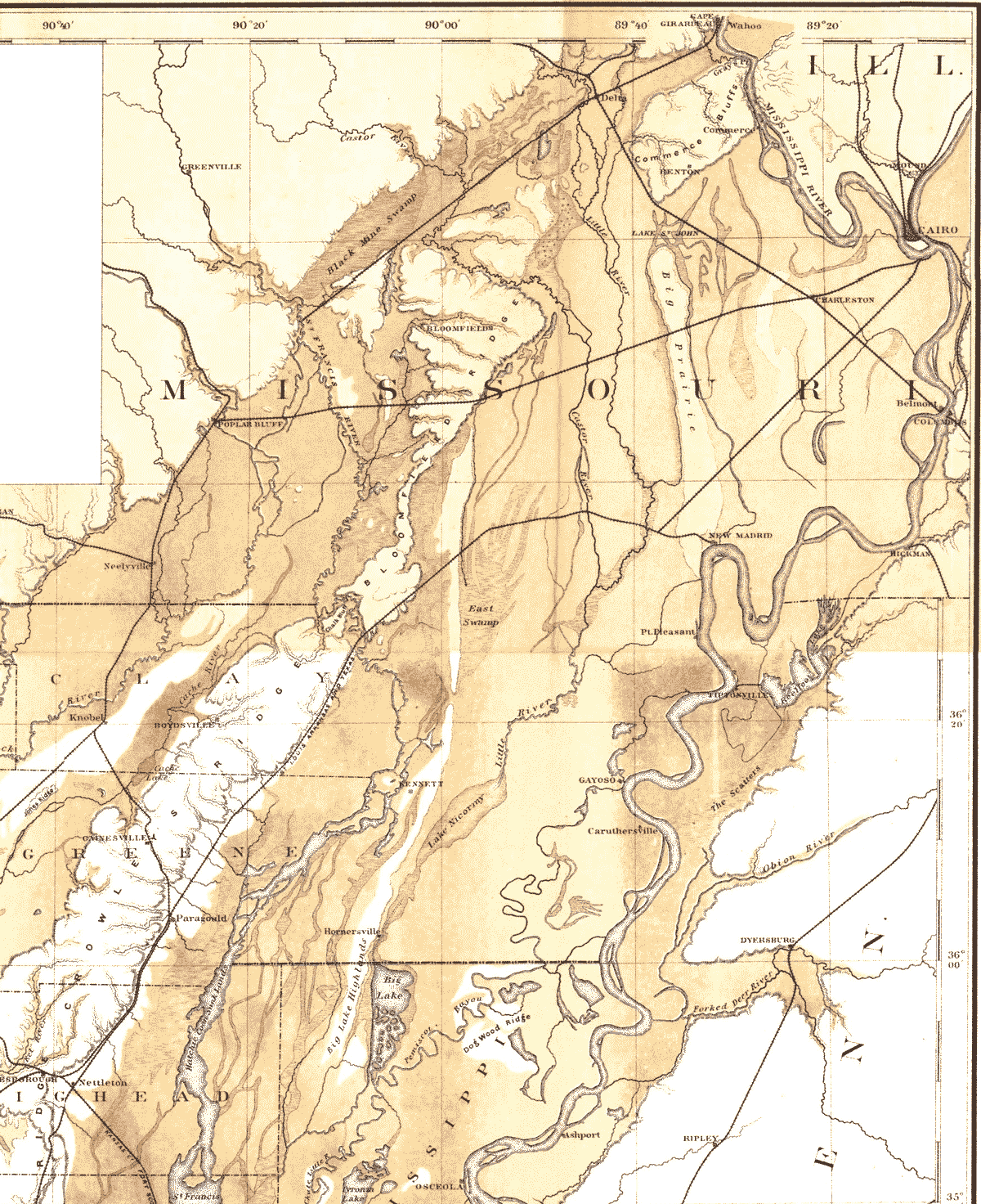
Crowley's Ridge Arkansas 1889 Topographical map. This one is 350k gif 1200 px wide with left and bottom trimmed. Original is 2 meg jpg, about 2400 px wide, at www.datasync.com/~rsf1/crowley.htm The Mississippi River in past eons turned sharply right at Cape Girardeau and ran to far left of map (hills at Poplar Bluff) before making its way southward. Then later in the ice age it broke a path through Oran, Delta, Bell City. Some 10,000 years ago, the Thebes gap broke through (see right edge of Commerce Bluffs), probably with help of water seepage and an earthquake along the Commerce Lineament. You can see the gap, pretty clearly on this map, just north of Thebes, where Benton Hills once connected with Southern Illinois. See topography. See the Little River coming from Cape, draining into Big Lake, west of Blytheville. The Little River drainage district did an enormous job of draining the swamp of southeast Missouri about 100 years ago, and still keeping it drained, financed with landowner tax per acre. The Little River shown in the southern Bootheel is now a series of five canals running side by side, emptying into the shallow Big Lake near Blytheville. |
Powered by Show-Me.net