|
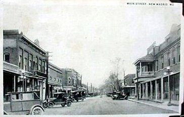
Downtown New Madrid in 1920s.
|
|
Higgerson School - preserved, near New Madrid. |
|
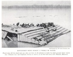
Chickens afloat in Mississippi River at New Madrid, 1937 flood. Clip from a magazine. |
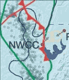
Map pages 1 | 2 | 3 | 4 | 5 | 6 | 7 | aerials | sitemap
|
Downtown New Madrid in 1920s.
|
|
Higgerson School - preserved, near New Madrid. |
|
Chickens afloat in Mississippi River at New Madrid, 1937 flood. Clip from a magazine. |
|
|
|
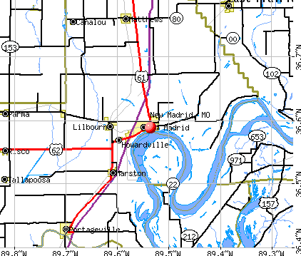
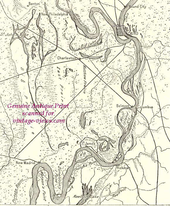
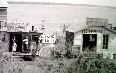
New Madrid fish market of the 1940s. Around the bend to the left 130 years earlier was a sudden waterfall. A bit farther was a Mississippi River uplift of several feet for a short time. To the right, less than a kilometer was another uplift. Seven miles or so, downstream to the right, was another waterfall. New Madrid's downtown dropped more than 10 feet in the 1812 quake.
|
|---|
|
|
 |
|
Mark Twain wrote of an interesting feud here. When the river ran backward for a few hours, a waterfall was at the 2:00-3:00 position, and another dam and waterfall at the 10:00 -11:00 position. The waterfall at 2:00-3:00 position lasted a few days, and lost lives on nearly 30 flatboats. See tour.
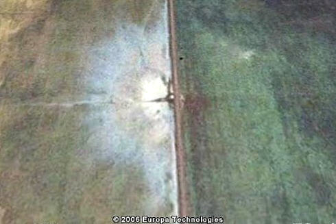
The above pic apparently showing strike-slip fault damage comes from tennesseeguy.wordpress.com. He offers no clue where or when.
|
Southernmost point of Illinois, confluence of Ohio on left and Mississippi on right, looking south toward Wickliffe KY.
Above was the infamous big Southeast Missouri Swamp - prior to early 20th century. Explorers Marquette & Joliet said this was the mosquitoes' home.


Reelfoot lake - Memphis newspaper photo

Osprey lands. Memphis newspaper photo
Towboat passes on Mississippi. Below is the Memphis pyramid and Mud Island.
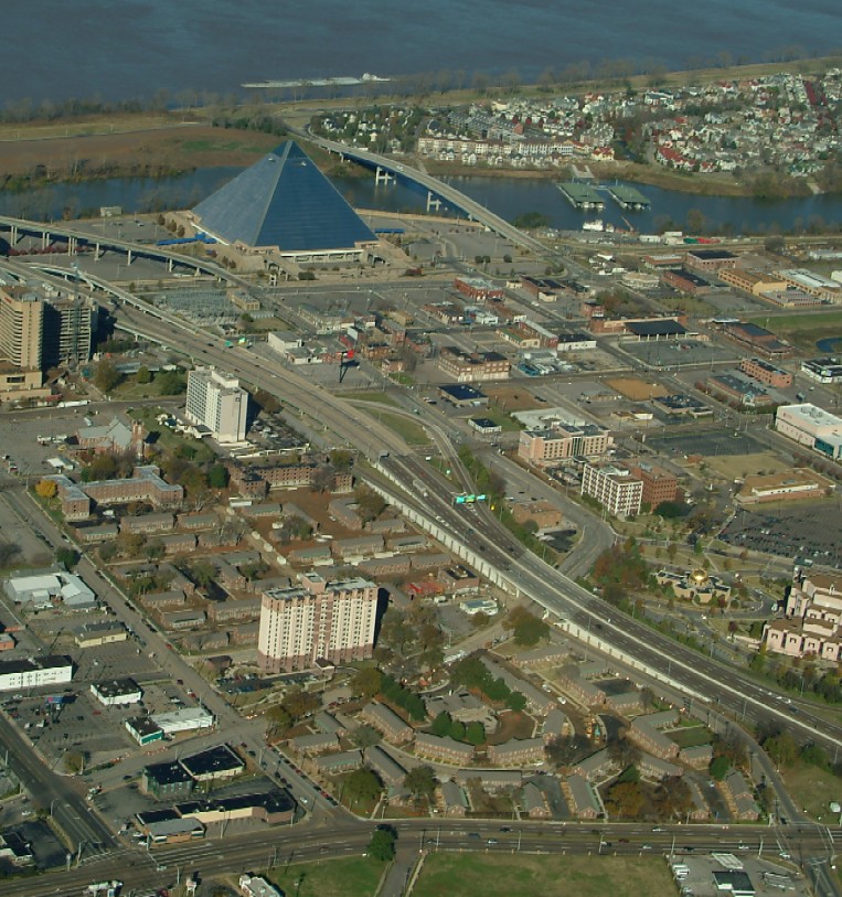
Aerial of Memphis above is probably from live.com
|
Photos by David Stewart |
|
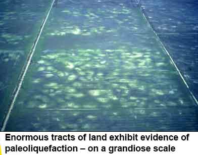
Credit: David Rodgers, MST.edu, Rolla. Click above image for larger. |
|
|
|
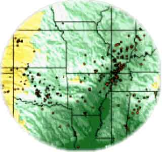
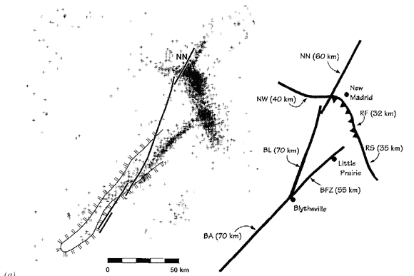
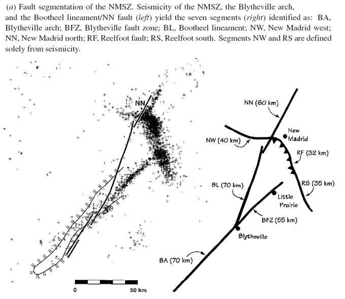
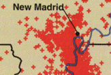
20-year cycle of quakes - USGS
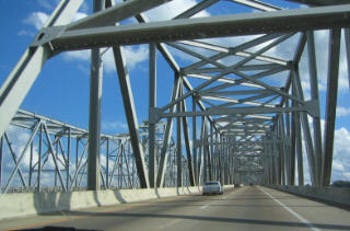 Bridges, probably at St. Charles, MO over the Missouri River. David Rogers, with Mo. Science & Technology Univ., Rolla, has done considerable research showing bridges and other structures in the Missouri river bottom would have a shake amplification of 600% if the New Madrid Fault went off, big time. Rogers and several graduate students have been modeling synthetic seismic events in the New Madrid region. Most of their scenarios are modeled after an 1895 earthquake with a magnitude of 6+ that was centered in Charleston, Mo. Most of St. Louis, located about 125 miles away from the epicenters of past New Madrid quakes, lies on 30 to 150 feet of loose, sandy sediment.
The preliminary results are sobering, says Rogers, who was recently appointed to Missouri’s Seismic Safety Commission by Gov. Matt Blunt. Data indicates ground shaking would be magnified about 600 percent within the flood plain of the Missouri River, a development that would predict soil liquefaction and cause most of Missouri’s existing long-span bridges to collapse. “You don’t even need a really big earthquake to do significant damage in the region,” Rogers says. “It could happen tomorrow. A moderate to strong New Madrid earthquake in 2006 would be a national disaster much like Hurricane Katrina, according to Rogers. “But you don't get a warning from an earthquake,” he says “At least with a hurricane, you can see the thing coming. “It’s more than just knocking down buildings and structures in St. Louis. The real economic threat to the entire country is the disruption of communication and transportation lines, and underground pipelines, that move through the Midwest.” |
Map pages 1 | 2 | 3 | 4 | 5 | 6 | 7 | aerials | sitemap
Powered by Show-Me.net


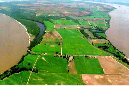
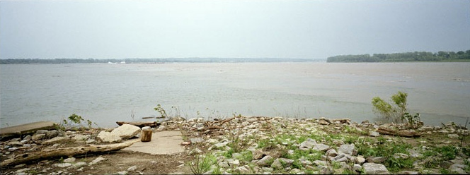
 Toward the bottom of the Mississippi River's New Madrid loop, the river level is about 10 feet higher on the east (right) than on the west. The distance across the neck of the loop is just under a mile. The land is generally 30 feet higher than the river. It is called the "